By BRIAN COOK AND MATTHEW PLEASANT
The 2024 hurricane season put many communities on notice and was a reminder of the perils of living in Florida’s coastal regions. Hurricanes Debby, Helene and Milton not only cost tens of billions of dollars but also disrupted thousands of lives. To mitigate these impacts, the Florida Department of Environmental Protection (FDEP), through the Florida Legislature, established the Resilient Florida program in 2021.
Resilient Florida has promoted flood vulnerability awareness with more than $100 million going toward planning efforts, including vulnerability assessments and adaptation planning, and more than $1.5 billion invested in resilience-based projects.
If done correctly, the first step in the process – the vulnerability assessment – can be an incredible tool that moves communities forward toward risk reduction. However, despite standardized requirements, there are noticeable differences in the outputs of the studies. In some cases, counts of vulnerable assets and maps of flooding hotspots fall short of providing interpretable data for local governments, leaving administrators uncertain how to apply the assessment toward actionable next steps.
This is often the case when mappings describe flood vulnerability in binary terms of ‘yes’ or ‘no,’ rather than an in-depth evaluation of ‘how’ or ‘why,’ or ‘in what context.’ Often, the results conclude with large-scale geographic information system (GIS) mappings and tabular data, which fail to humanize the vulnerability, leaving out spatial or other detailed information that is needed to develop an appropriate response. As such, momentum can be lost between the risk assessment phase and the formulation of an adaptation plan. Ultimately, studies are in danger of being left on the sidelines, while communities move forward with traditional capital improvement priorities that do not actively incorporate climate hazards.
In this context, we can review a few recent vulnerability assessments that have proven useful and that have already led to changes in capital improvement expenditures, increased multi-agency coordination and the development of project opportunities.
The City of Tampa is the state’s third-largest city, with 127 miles of coastline, and is home to Port Tampa Bay, MacDill Air Force Base, Tampa International Airport, Tampa General Hospital and the University of South Florida. It has a diverse population spread out over peninsular, riverine and inland areas, many of which are vulnerable to flooding.
During Tampa’s recent assessment process, GIS data was used to locate vulnerable areas, similar to other assessments, but this was the starting point not the conclusion. A second-phase analysis reviewed localized conditions through multi-scaled mappings and ground-level imagery. Other information included access issues, spatial conditions and community use. As an example, a beach park was identified as a primary cultural amenity within the city.
A documentary film evaluated site characteristics and community programming to ensure that adaptation measures would promote rather than diminish the use of the site. Hydrodynamic modeling helped to ensure that risk scenarios were understood through an engineering-based technical lens. Costs were also described to consider the ‘business case’ for prioritized adaptation measures, so the city could immediately move forward with grant requests.
In other instances, individual vulnerable pump stations were shown using site-level photography, and interviews with the city’s utility department helped to craft the story of wastewater movement through the city. This process also identified uniquely vulnerable infrastructure, such as a 54-inch pressurized concrete pipe under a waterfront street with a 100-year-old seawall.
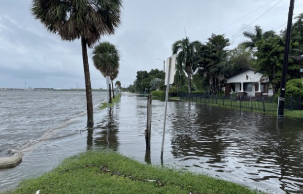
The City of Palmetto’s recent vulnerability assessment was similar. It included place-based data and detailed focus area studies. In addition to typical mappings of floodplains and assets, the report contains site-scaled studies with photos and nuanced sets of information. In one instance, a two-page spread describes a vulnerable coastal road and dates when it had been overtopped by high tides.
These additional details helped administrators understand the urgency, the community involved and the spatial characteristics of the asset so that decisions could be made appropriately. The city has decided to move forward with a detailed study of the road as a focus area in their upcoming adaptation plan, which will also be funded by the FDEP.
As Florida communities move forward, with the state’s support, we must continue to develop a culture of resilience by improving on methods and deliverables. These examples were shared as a starting point for continued dialogue and to highlight practical approaches that have led to success. The State of Florida has provided an incredible opportunity for communities to address their coastal and inland flooding challenges. If thought is given to the ‘how’ and ‘why’ of flooding, in addition to the ‘what’ and ‘where,’ successful implementation of projects will soon follow.
Brian Cook, PLA, is Director of Urban Design and Resilience at Applied Sciences Consulting, Inc. Matthew Pleasant, AICP, CFM, is Applied Sciences’ Planning Manager.